Maps/Data
CAMPO Maps
Click on the sidebar links at the right (desktop) or bottom (mobile) of the page to access CAMPO maps.
2050 Metropolitan Transportation Plan (MTP) Development
2050 MTP (Approved) - Interactive Map
2050 MTP Maps & Projects List (Approved) - PDF
Forecast Maps
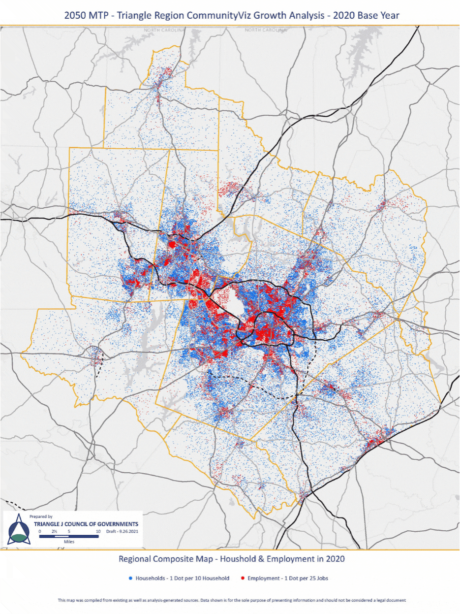
The following animated maps ("GIFs") were produced for the 2050 MTP Development process.
Household and Jobs Growth 2020 to 2050
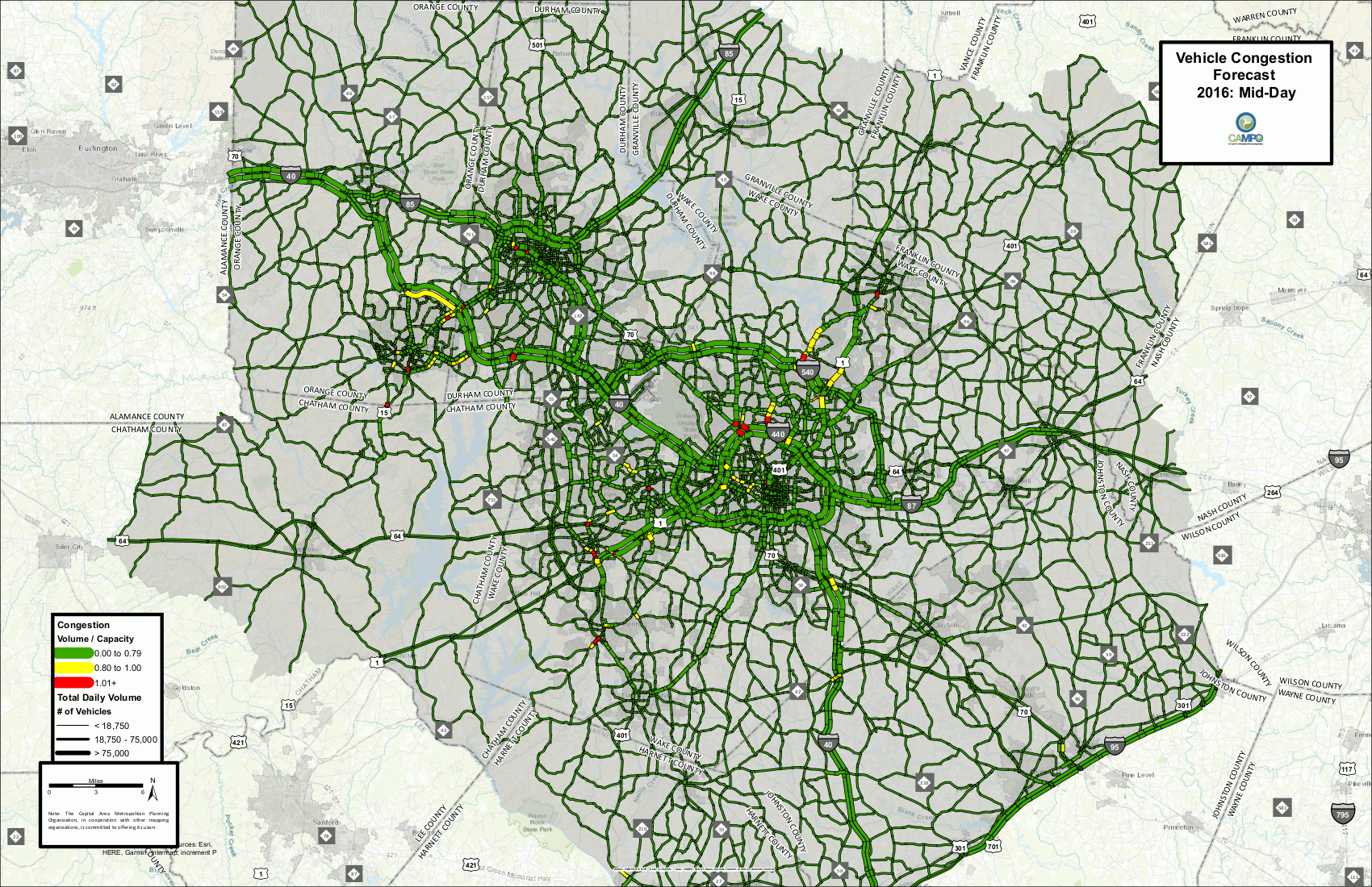
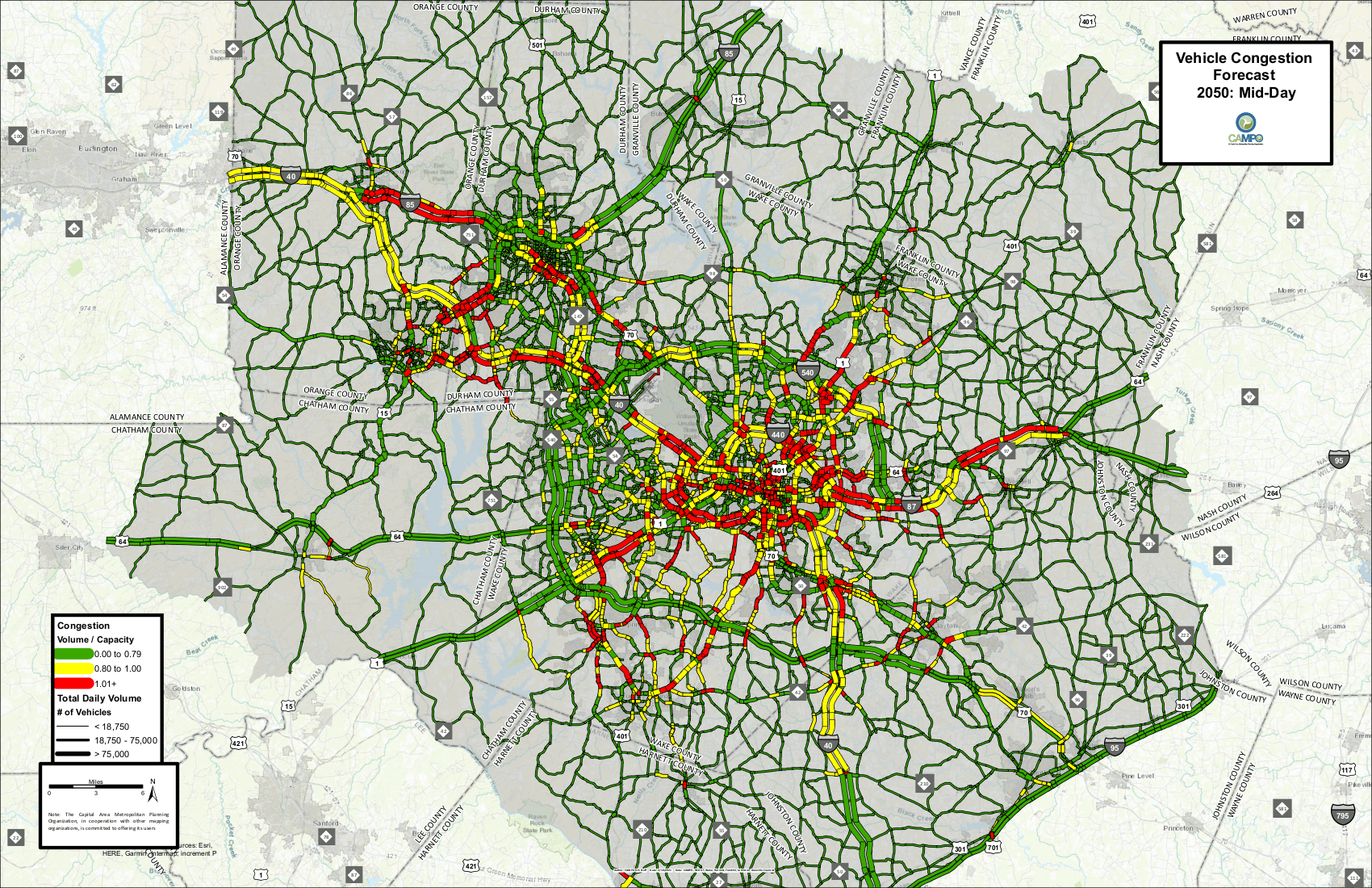
Vehicular Forecast
Using the Triangle Regional Model, forecasts of vehicular congestion were created based on existing levels and estimates for future (2050) levels on the region's roadways. Both maps are animated based on snapshots in a typical 24-hour period, demonstrating the morning and afternoon peak, and mid-day periods.
2016
2050 - E+C (visit 2050 MTP webpage for details)
NCDOT STIP Map
NCDOT also provides a map of projects that are included in the approved State Transportation Improvement Program.